
The Oaks Plantation – Georgetown – Georgetown County
Basic Information
- Location – Westside of the North Santee River, Georgetown, Georgetown County
Plantation lands are bordered by US 17/701, SC Secondary Road 24 (Powell Road), and the North Santee River (3).
- Origin of name – The Oaks likely got its name because of the plethora of oak trees (1)
- Other names – ?
- Current status – Privately owned and operated as a private hunt club (1)
Timeline
- 1705 – Earliest known date of existence (1)
John Sauseau, a French Huguenot settler, received a grant from the Lords Proprietors (2, p. 685).
- 1731 – John Sauseau died leaving his property along the Santee River in trust for his grandchildren (2, p. 685).
- 1733 – Sauseau's son-in-law sold the property to William Buchanan (2, p. 685).
- ? – House built
Buchanan, his wife Deborah, and five children lived at the plantation. He cultivated rice and ran a successful ferry business (2, p. 686).
- 1757 – Buchanan died. In his will he left his property, including a house, to his wife for her life and then the property was to go to his son James (2, p. 686).
- 1768 – James Buchanan sold the 500 acre property his sister's husband Francis Withers (2, p. 686).
- ? – Francis's son Robert Francis Withers became owner (2, p. 687).
- 1793 – Robert Withers sold the plantation, which contained 1,050 acres, to brothers William and Isaac Mazyck (1) and (2, p. 687).
- 1806 – The Mazycks sold The Oaks to their brother-in-law John Hume. Hume was the largest landowner in the area and made his home at Hopsewee Plantation. There was a two-story house on The Oaks at this time (2, p. 688).
- 1841 – Hume passed away stipulating the large majority of his property, including The Oaks, be sold and the proceeds divided among his children (2, p. 688).
- 1855 – John Hume's son, Robert Hume, sold The Oaks Plantation, Jutland Plantation, and Bear Hill Plantation to Augustine Louis Taveau (2, p. 688).
- 1858 – Taveau had financial difficulties and sold The Oaks to Robert H. Lucas (2, p. 689).
- 1867 – Lucas sold the plantation jointly with several other tracts to William Birney. On the same day, Birney sold the property to Elliott Maxwell Lucas (2, p. 689).
- 1871 – William Birney's son, James Birney, foreclosed on the mortgage his father issued to Lucas on The Oaks (2, p. 689).
- 1905 – James Birney, Mary Birney Lewis, and Janet Birney Brewster sold the plantation to Oneida Timber (2, p. 690).
- 1906 – Oneida Timber sold the property for $5.00 to D.N. Bourne, B.O. Bourne, and J.M Bourne (2, p. 690).
- ? – Westvaco owned and managed the majority of the property (2, p. 690).
- ? – Mr. and Mrs. Herbert J. Butler I purchased The Oaks Plantation (1).
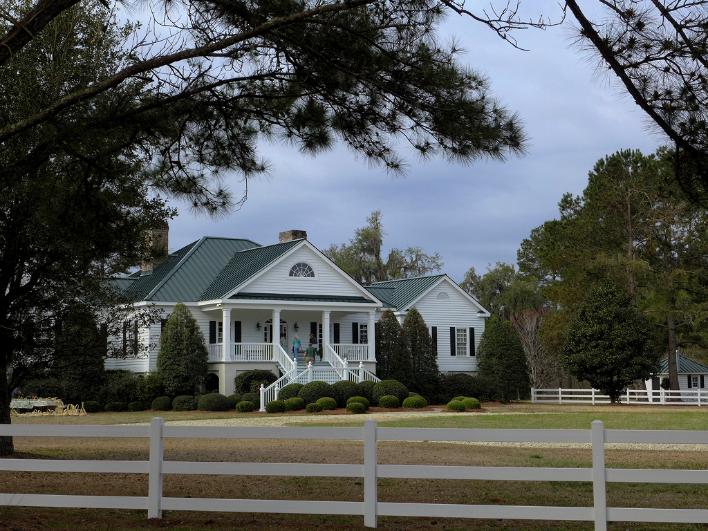
- 1999 – The Butlers built the current house based on 19th century plantation architecture (1).
- 2014 – Herbert J. Butler I was owner of The Oaks Plantation and operated it as a private hunt club for quail, deer, duck, turkey, and feral boar. The Oaks was 1,600 acres at this time and included the 400 acre Lucas Tract across Powell Road, part of Crow Hill Plantation and Commander Island which is located directly across The Oaks on the North Santee River (1).
Land
- Number of acres – 500 in 1768; 1,050 in 1793; 1,600 in 2014 (1) and (2, p. 686)
- Primary crop – Rice (1)
Slaves
- Number of slaves – 46 in 1757 (2, p. 686)
Buildings
- A two-story house was constructed on The Oaks sometime in the 1700s. The current house was built in 1999 based on 19th century plantation architecture (1).
References & Resources
- Information contributed by Charlton Butler including the text of the plantation's SC Highway Historical Marker
- Suzanne Cameron Linder and Marta Leslie Thacker, Historical Atlas of the Rice Plantations of Georgetown County and the Santee River
(Columbia, SC: South Carolina Department of Archives and History, 2001)
 Order Historical Atlas of the Rice Plantations of Georgetown County and the Santee River
 - Information contributed by Gazie Nagle